Southern Osteth
Related topics: Osteth
| Warning: Unverified Content This page may not match in game information. Please correct any errors that exist and remove {{Needs Verification}} from the top of this page! For more information see Help:End of Retail Content. |
| Introduced: | Release |

Description
The large area to the south of Osteth, made up mostly of the Linvak Mountain Range. It is joined to the Direlands by way of the Southern Landbridge.
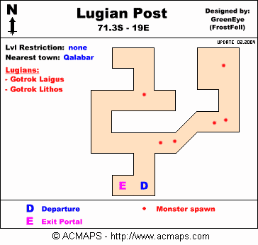
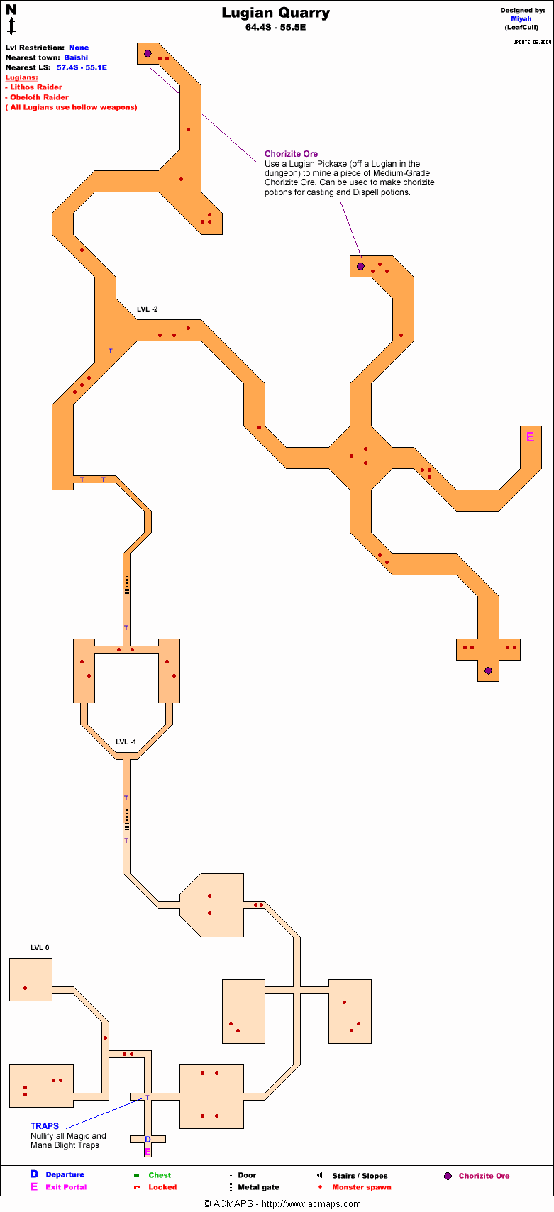
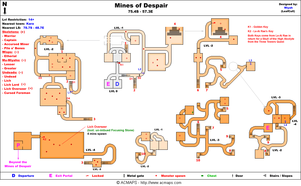
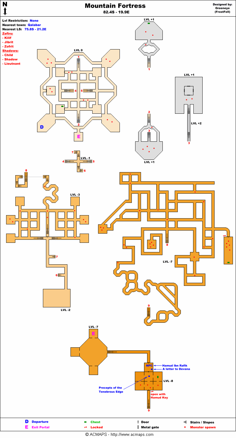
"Site of the Mattekar-plagued Linvak Mountains, this region is also filled with numerous labyrinthine dungeons. In Qalaba'r, the scribe can direct adventurers to a nearby Lugian outpost. More experienced explorers should visit the Scribe Brother Gonun of Shoushi. He knows the path to an extremely treacherous descent, where Sho artifacts await the intrepid. It is best to form a fellowship of friends before attempting this perilous quest. First, though, you must step through the portal and answer Asheron's call yourself."[1]
NPCs
| NPC Name | Location | Type | Details |
| Le-Ai Rea | 75.9S, 57.3E | Quest | Focusing Stone Quest |
| Master Shoyanen Kenchu the Archmage | 63.4S, 85.9E | Shopkeeper | Magical Supplies |
| Archmage (Female Sho) | 82.1S, 63.7E | Shopkeeper | Magical Supplies |
| Jolly Snowman | 65.4S, 44.1E, 73.2S, 26.8E | Shopkeeper | A Frozen Note |
| Peddler (Xinh) | 82.1S, 63.7E | Shopkeeper | Basic Supplies |
| Snowman | 70.4S, 54.5E | Shopkeeper | A Frozen Note, Poofy Snowballs |
| Hasina bint Rira | Random Spawn | Quest | Hieromancer's Armor |
| Zairente Ra-Yao | Random Spawn | Quest | Hieromancer's Armor |
Geographic Areas
Towns
Items
![]() Argenory Plant
Argenory Plant![]() Hennacin Plant
Hennacin Plant![]() Lapyan Plant
Lapyan Plant![]() Minalim Plant
Minalim Plant![]() Snowflower
Snowflower![]() Verdalim Plant
Verdalim Plant
Points of Interest
Emboldened POI are those indicated on the Ingame Map as yellow dots. See also Points of Interest Map
Lifestones
Town Lifestones are not displayed.
|
Map Key:
Portals
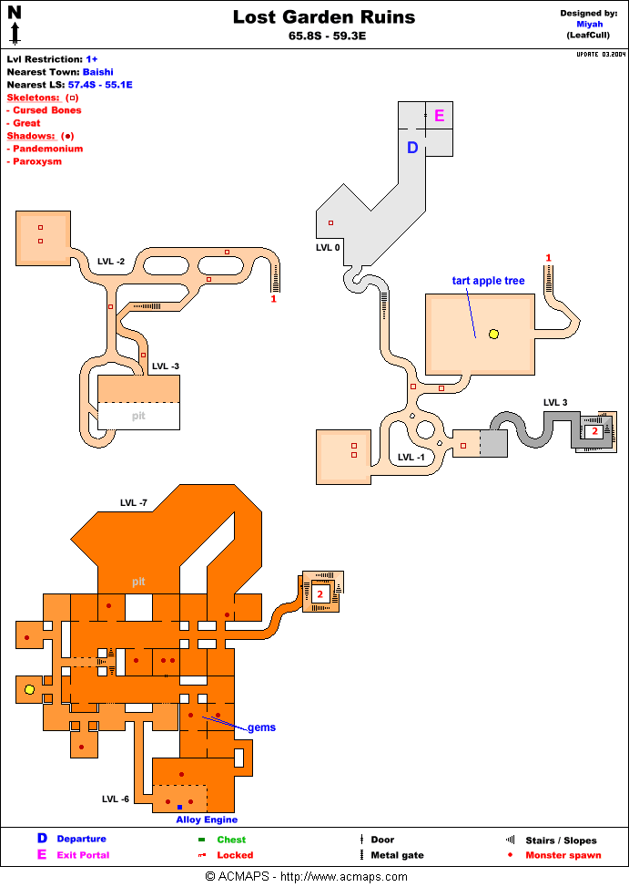
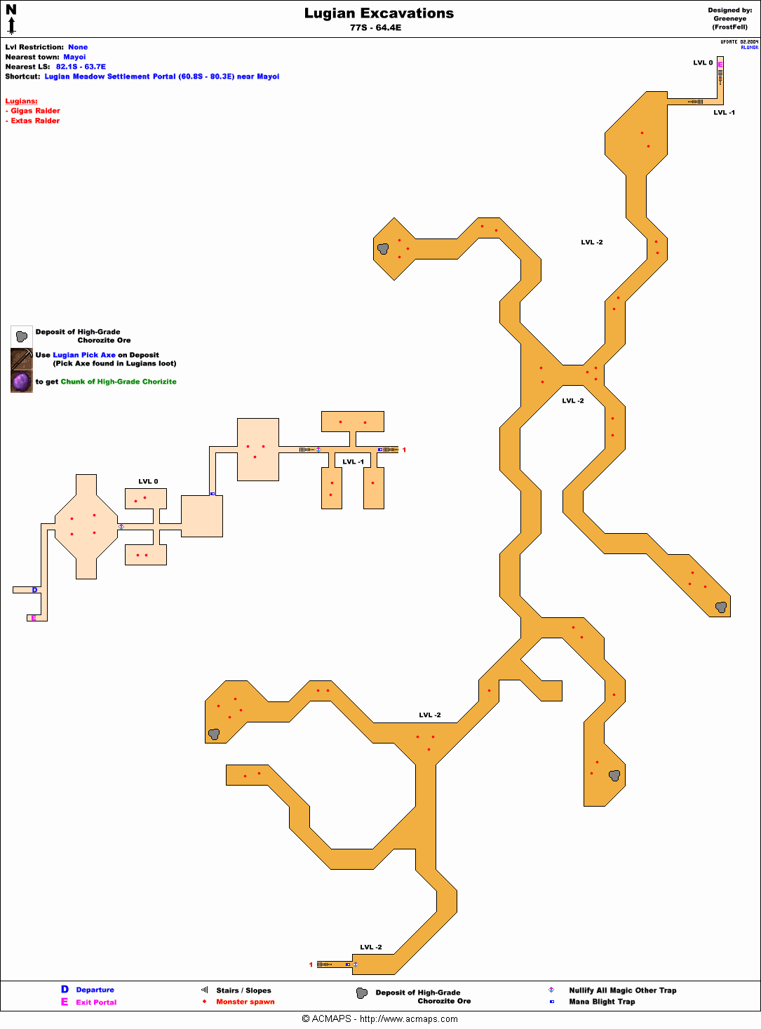
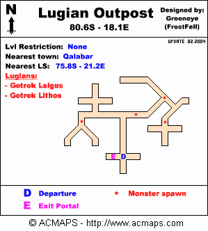
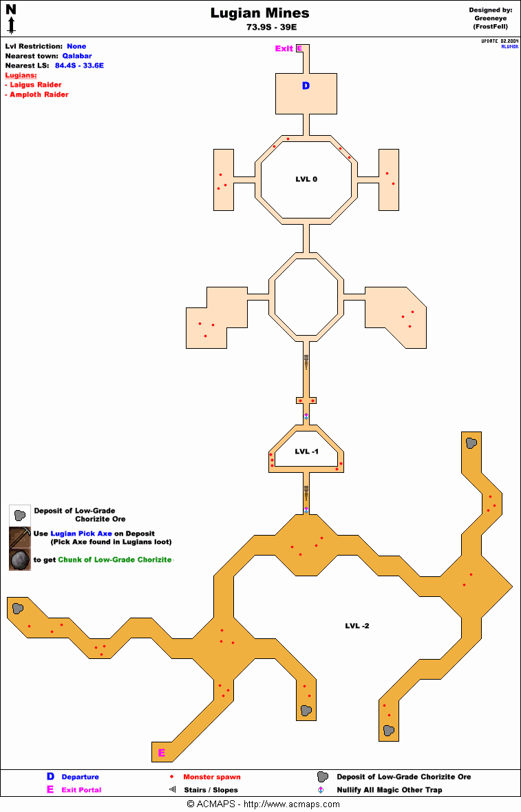
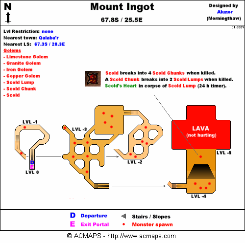
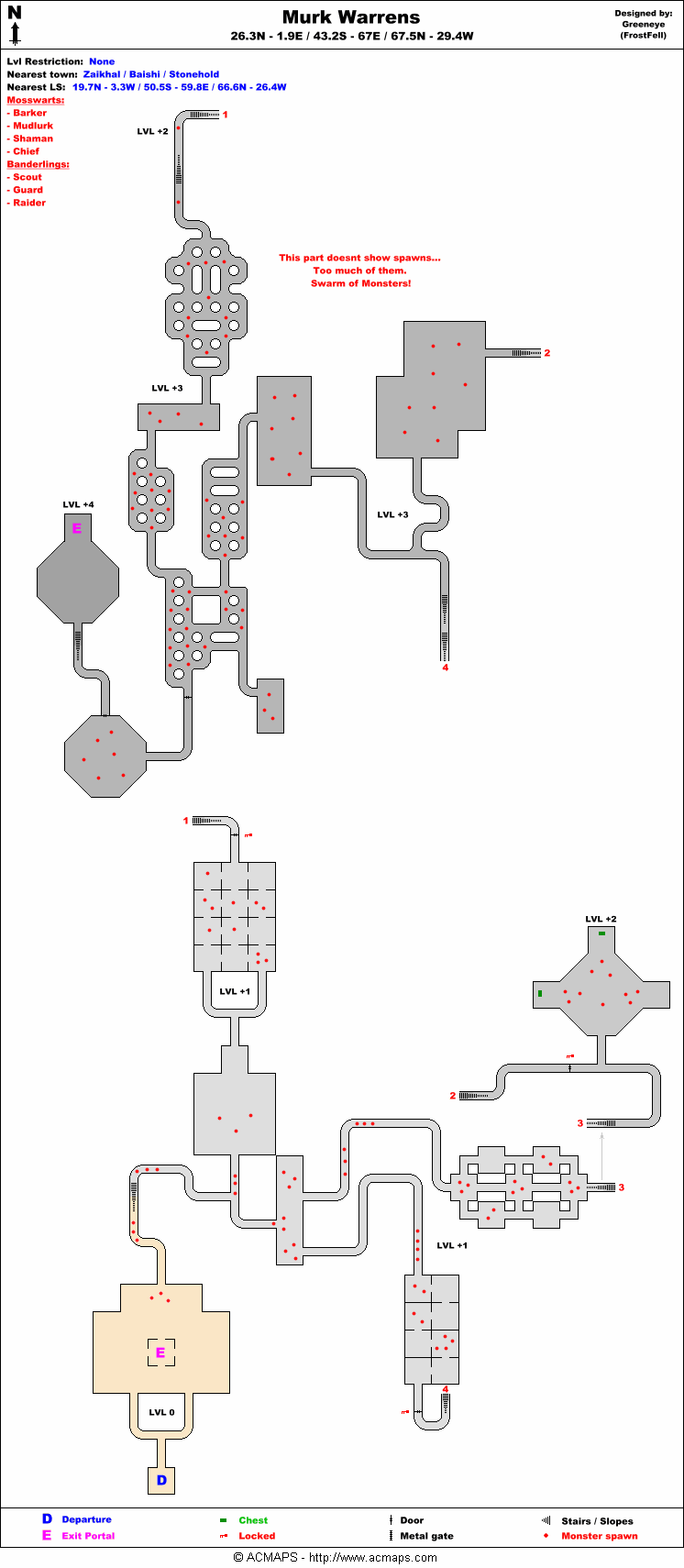
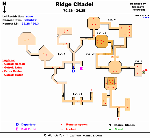
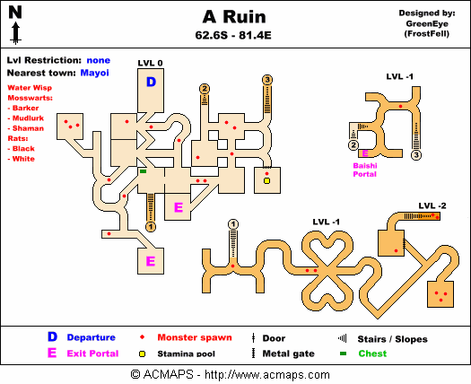
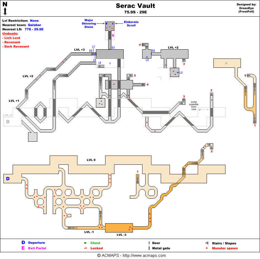
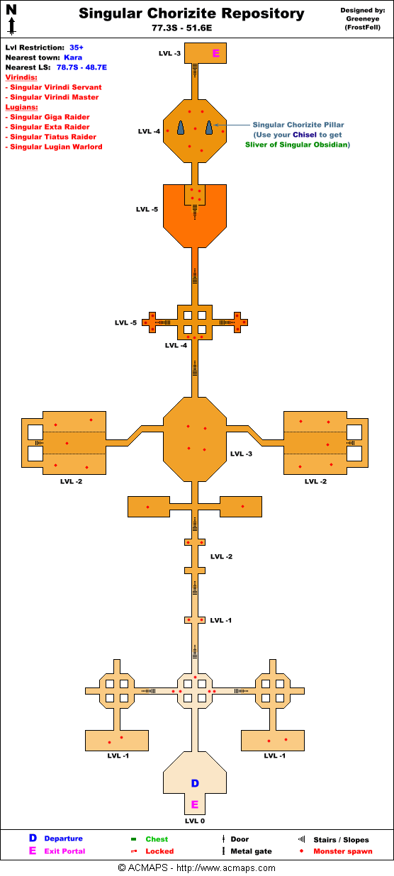
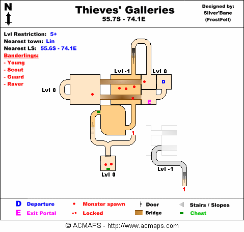
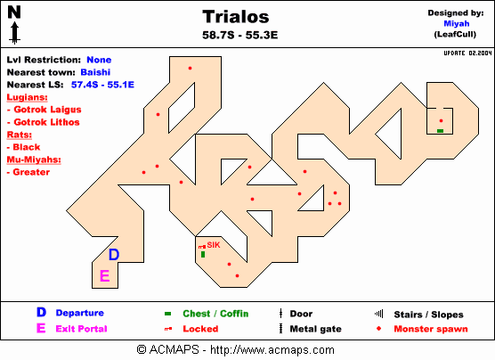
Dungeons
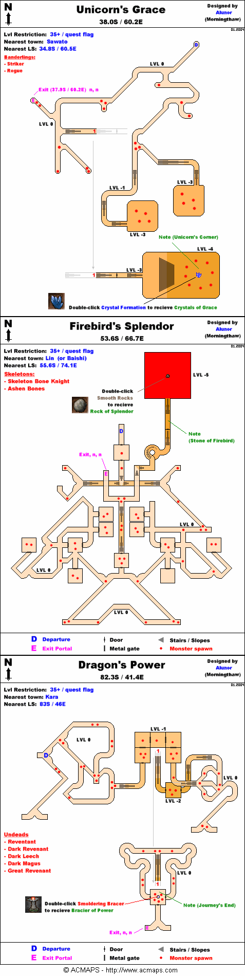
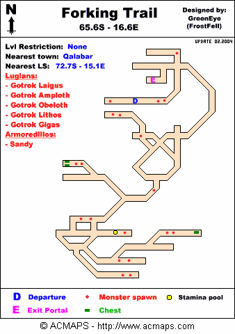
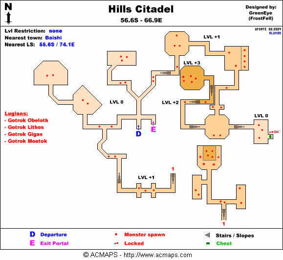
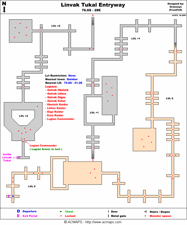
CreaturesNote: Most landscape creatures have a spawn map on the creature's article page. Images
References |


