Middle Osteth

From Levistras
Jump to navigation Jump to search

Related topics: Osteth

Warning: End of retail content
This page has been imported from the Asheron's Call Community wiki, and reflects the content at the end of retail. Please correct any errors that exist and remove {{Needs Verification}} from the top of this page! For more information see Help:End of Retail Content.
Introduced:  Release
Middle Osteth

Description

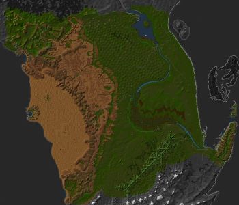
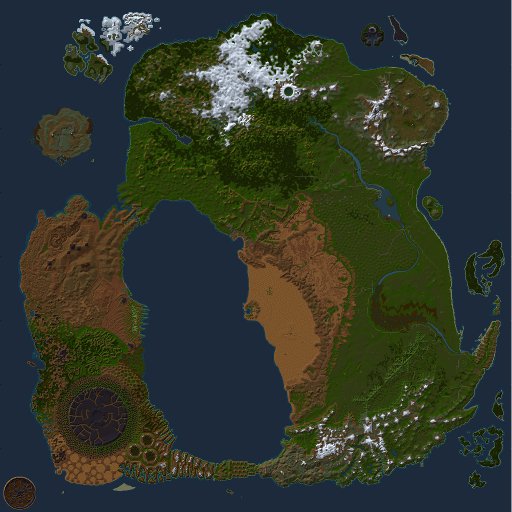
"All three human heritages possess footholds in this immense, fertile plain. At the mouth of the River Prosper, the new Sho community Hebian-to has erected the Laughing Kirin Hall and the Shining Shield Tavern to give would-be vassals a place to seek out suitable patrons. To the north, the Isle of Tears rises in the midst of Lake Blessed. This island is the legendary site of the Underground City, where the hero Thorsten Cragstone dwelt during the Olthoi war, and where some say his tomb now rests amid lairs of vicious Mosswarts."[1]

Towns and Regions of Middle Osteth

Aluvian Realm

Towns
Regions

Sho Nation

Towns
Regions

Gharu'ndim Kingdom

Towns
Regions

Points of Interest

Emboldened POI are those indicated on the Ingame Map as yellow dots. See also Points of Interest Map

Middle Osteth (North)

Middle Osteth (South)

Lifestones

Town Lifestones are not displayed.

Map Dereth Map Point MP Town.png Map Point MP Town.png Map Point MP Town.png Map Point MP Town.png Map Point MP Town.png Map Point MP Town.png Map Point MP Town.png Map Point MP Town.png Map Point MP Town.png Map Point MP Town.png Map Point MP Town.png Map Point MP Town.png Map Point MP Town.png Map Point MP Town.png Map Point MP Town.png Map Point MP Town.png Map Point MP Town.png Map Point MP Town.png Map Point MP Town.png Map Point MP Town.png Map Point MP Town.png Map Point MP Town.png Map Point MP Town.png Map Point MP Town.png Map Point MP Town.png Map Point MP Town.png Map Point MP Town.png Map Point MP Town.png Map Point MP Town.png Map Point MP Town.png Map Point MP Town.png Map Point MP Town.png Map Point MP Town.png Map Point MP Town.png Map Point MP Town.png Map Point MP Town.png Map Point MP Town.png Map Point MP Town.png Map Point MP Town.png Map Point MP Town.png Map Point MP Town.png Map Point MP Town.png Map Point MP Town.png Map Point MP Town.png Map Point MP Town.png Map Point MP Town.png Map Point MP Town.png Map Point MP Town.png Map Point MP Town.png Map Point MP Town.png Map Point MP Town.png Map Point MP Town.png Map Point MP Town.png

27.4N, 63.7E - Near Merchant Seller 23.4N, 7.7W - Wilderness Fort Map Point LS.png Map Point LS.png 21.0N, 18.6E - Mount Zabool 19.7N, 3.3W - Gharu'ndim Outpost 12.2N, 2.4E - Four Towers Map Point LS.png 4.4N, 35.5E - Adventurer's Haven Map Point LS.png Map Point LS.png Map Point LS.png Map Point LS.png 8.7S, 53.8E - Folthid Estate 8.8S, 75.2E - Southeast of Dryreach Map Point LS.png 19.8S, 47.9E - Blackmire Swamp Map Point LS.png Map Point LS.png Map Point LS.png 28.6S, 78.1E - Advocate Ruins 30.3S, 94.7E - South of Tou-Tou Map Point LS.png Map Point LS.png Map Point LS.png 34.8S, 60.5E - South of Sawato 34.4S, 64.9E - Fycheck Outpost Map Point LS.png Map Point LS.png Map Point LS.png

Map Key:
Map Point LS.png - Asheron's Lifestones
Hover over a Lifestone on the map to view its location name, or click to view its information page.

Portals

Location Coords Destination Coords Restrictions
Empyrean Pillars 20.9N, 25.9E North Direlands 24.4N, 53.8W 12+
Sylsfear Dungeon 11.1N, 14.7E Direlands Midlands 88.3S, 64.5W 21+
Dryreach 8.1S, 74.5E East Direlands Swamp 39.7S, 54.1W 12+
Merchant Cellar 26.3N, 63.9E High Mountain Valley 65.2S, 60.3E None
Gharu'ndim Outpost 19.7N, 3.3W North Desert Edge 4.7S, 3.1W None
A'mun Desert 18.7S, 6.8E Southern Mt. Esper Lifestone 56.8N, 12.9E 12+


Dungeons

See Towns and Regions of Middle Osteth pages for dungeon lists.

Creatures

See regional area pages for the their creature spawns:

Aluvian Regions

Gharu'ndim Regions

Sho Regions

Images

References