File:Point Map 512 2009-02.jpg
From Levistras
Jump to navigation
Jump to search
No higher resolution available.
Point_Map_512_2009-02.jpg (512 × 511 pixels, file size: 56 KB, MIME type: image/jpeg)
Summary
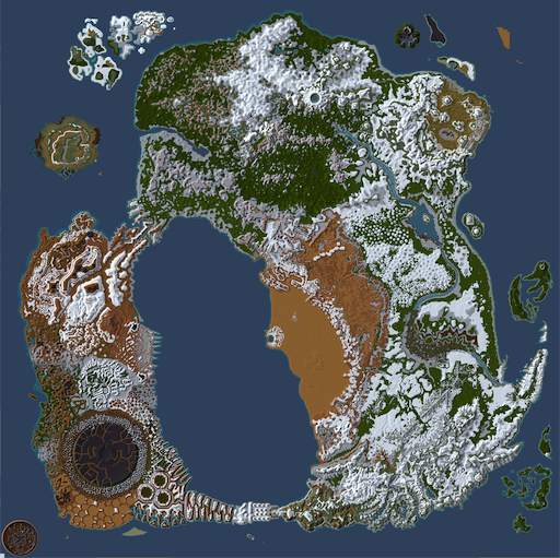
Small map of Dereth as of 2009-02, with all of the currently snow covered areas shown in white.
Licensing:
| Copyright Details | |
| License: | Creative Commons Attribution-ShareAlike License v. 3.0 |
| Source: | User created work
|
| Author: | Image uploader |
| If you think this image is incorrectly licensed you may discuss this on the image's talk page. | |
File history
Click on a date/time to view the file as it appeared at that time.
| Date/Time | Thumbnail | Dimensions | User | Comment | |
|---|---|---|---|---|---|
| current | 16:46, 14 December 2020 | | 512 × 511 (56 KB) | Maintenance script (talk | contribs) |
You cannot overwrite this file.
File usage
The following page uses this file:
Metadata
This file contains additional information, probably added from the digital camera or scanner used to create or digitize it.
If the file has been modified from its original state, some details may not fully reflect the modified file.
| Orientation | Normal |
|---|---|
| Horizontal resolution | 72.009009009009 dpi |
| Vertical resolution | 72.009009009009 dpi |
- Home
- Quests
- Items
- Patches
- Lore
- Random Page
- Recent Changes